

Coppanagh [Sliabh Chopanai]
Good walks are even better shared.
Overview
Coppanagh [Sliabh Chopanai]
Introduction
Coppanagh, or Sliabh Chopanai to those partial to a bit of Irish, rises to an elevation of 493 meters in the beautiful Sperrin Mountains of Northern Ireland. With its Marilyn classification, it’s a popular choice for outdoor enthusiasts looking for a delightful challenge without the headaches of more sky-scraping peaks.
Geology
This area is predominantly sandstone and siltstone, which makes for interesting terrain and some lovely views of stratified rock layers. Perfect for those geology buffs out there who love a good rock story!
Routes
The most common route up Coppanagh is the Sliabh Chopanai Route. It’s about 4.5 km and should take around 2 hours depending on your pace—though I must warn you, if you stop for too many selfies, it might take a bit longer! The trail offers a good mix of grassy paths and rocky sections, with plenty of opportunities to enjoy the surrounding nature.
Summit Features
The summit is marked with a stone cairn, a perfect spot to take a breather and ponder the mysteries of life (or just how you’re going to tackle that next hill!). If you’re lucky, you might even spot a solitary sheep contemplating its own existential crisis.
Terrain Type
Expect a mix of grassy meadows and rocky patches, with the delightful addition of boggy areas that can test your resolve. Waterproof footwear is a must unless you fancy a spontaneous dip.
Views
On a clear day, you’re in for a treat! The summit provides breathtaking panoramic views of the Sperrins and the Antrim Hills. Spring and autumn are particularly lovely times for visors; however, even summer can surprise you with drizzle—don’t forget your jacket!
Hazards
Watch your step in those boggy bits—they can be surprisingly slippery—and keep an eye on weather forecasts to avoid sudden storms.
Nearby Summits
If you’re up for more, consider conquering Mullaghaneany, just a hop, skip, and a jump away and standing proudly at 488 meters.
Access
Getting there is fairly straightforward. The nearest parking is at S645426, and good luck finding public transport unless you don’t mind a bit of a walk from Draperstown!
Facilities
Facilities are basic. Draperstown has a café where you can refuel after your adventure, and public conveniences are available. Just remember, they might run out of hot water—better keep that in mind before you get too adventurous.
History
The name Coppanagh, meaning 'little in a hollow', directly reflects the landscape and the mountain’s appeal as a natural playground for locals and visitors alike.
Conclusion
Whether you’re a seasoned hiker or a novice, Coppanagh offers a spellbinding experience. Just remember to leave no trace and take nothing but pictures. Happy hiking!
Explore routes near Coppanagh [Sliabh Chopanai]
Public walks starting within 80 km of this hill. Nearby does not mean a route reaches the summit; check its map and access before setting out.
No public routes are currently listed within 80 km of Coppanagh [Sliabh Chopanai] on Walkmates. This does not mean there are no paths here. Explore the map and check local access information before planning a walk.
Route planning notes
These notes describe possible approaches, not verified navigable routes or permission to cross land. Check current paths, local access rules and conditions before setting out.
Sliabh Chopanai Route
A scenic but straightforward ascent, starting from an established trailhead, this route provides a combination of rocky paths and grassy slopes.
Make a day of it, together
Find someone to share the walk with, or organise a day out along a route you like.
Photo Gallery
View all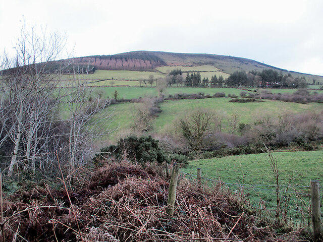 Photo could not load
S6543 : Fields and Hillside
kevin higgins
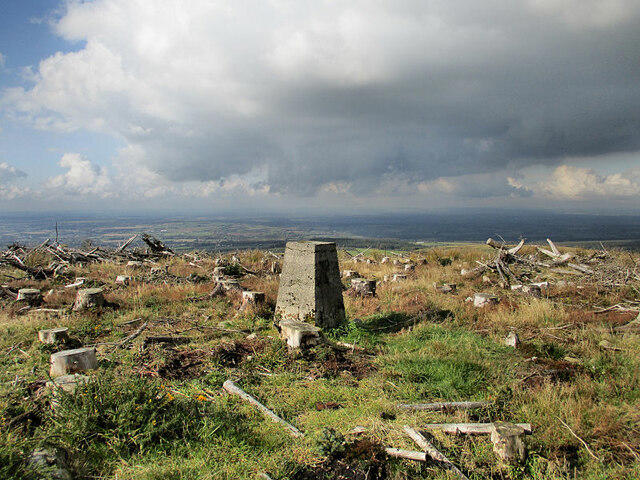 Photo could not load
S6543 : Trig Pillar
kevin higgins
Hill facts and local notes
Classifications
Elevation
365m
1,198 ft
Prominence
214m
Coordinates
52.5385, -7.0413
S651434
OS Map
68
At the Summit
At the summit, hikers will find a stone cairn that serves as both a marker and a great excuse to catch your breath. You might even get a view of a bog-standard sheep or two!
Terrain & Geology
Primarily composed of sandstone and siltstone, Coppanagh boasts interesting geological formations typical of the Sperrin region, shaped during the Caledonian Orogeny. The layers tell a tale of ancient seas and shifting landscapes.
Views & Scenery
From the summit, you can enjoy panoramic views of the surrounding Sperrin Mountains, as well as the distant Antrim Hills on a clear day.
History & Heritage
Name Origin
The name 'Coppanagh' derives from the Irish 'Cuaipín', meaning 'little in a hollow', reflecting the mountain's geographical features.
Historical Significance
Coppanagh is part of a range that has historical significance in terms of local folklore and has been a natural gathering point for centuries.
Getting There & Facilities
Check current local access restrictions, parking rules and transport timetables before travelling. These notes do not confirm public access to the summit.
Parking
There is a small parking area at the trailhead located at grid reference S645426, just off the road leading towards the Sperrins.
Public Transport
Public transport options are limited; the nearest bus stop is in Draperstown, about 10 km away. A taxi might be needed.
Nearby Facilities
Facilities are sparse; a small café in Draperstown serves essentials and there are public toilets available there.
Safety Information
Known Hazards
- Boggy patches can be treacherous, particularly in wet conditions. Also, be wary of sudden weather changes common in mountainous areas.
General Safety Tips
- Check weather conditions before setting out
- Carry appropriate clothing and equipment
- Let someone know your planned route
- Take a map, compass, and GPS device
- Carry emergency supplies: food, water, first aid kit, torch
Hills
Some common questions about the hills answered
Are there group walks up Coppanagh [Sliabh Chopanai]?
Many walkers use Walkmates to join or organise walks with others. You can check for group walks around Coppanagh [Sliabh Chopanai] through the maps
Are there other walkers around Coppanagh [Sliabh Chopanai]?
Activity varies by location and time, but Walkmates lets you see whether others have shared walks or shown interest in this area. Find other people through the walking friends search walking friends for Coppanagh [Sliabh Chopanai] search or of course create your own walk for Coppanagh [Sliabh Chopanai]
Can I organise a walk to Coppanagh [Sliabh Chopanai]?
Yes. If there aren’t any walks listed already, you can create a walk and make it available for others to join.
If you're signed up to Walkmates, you can create a walk to Coppanagh [Sliabh Chopanai].
How do I find a walk up this hill?
There are often multiple ways to walk this hill, depending on experience and route preference. Walkmates helps you explore walks and routes that others have shared.
Can I suggest a new route up Coppanagh [Sliabh Chopanai]?
Yes. You can suggest or create routes to share with others. Walkmates focuses on the social side of walking, so routes are used to help people organise walks and explore areas together, rather than as detailed navigation tools or route libraries.
Other uses really appreciate knowledgeable walkers sharing their routes. Share your favourite route to Coppanagh [Sliabh Chopanai] here
The is an error or something incorrect about this hill. How do I let you know?
We always strive to keep the information on Walkmates as accurate as possible. If you find an error, please let us know through the contact form and we'll aim to correct it as quickly as possible
Community Discussion
Comments
Location
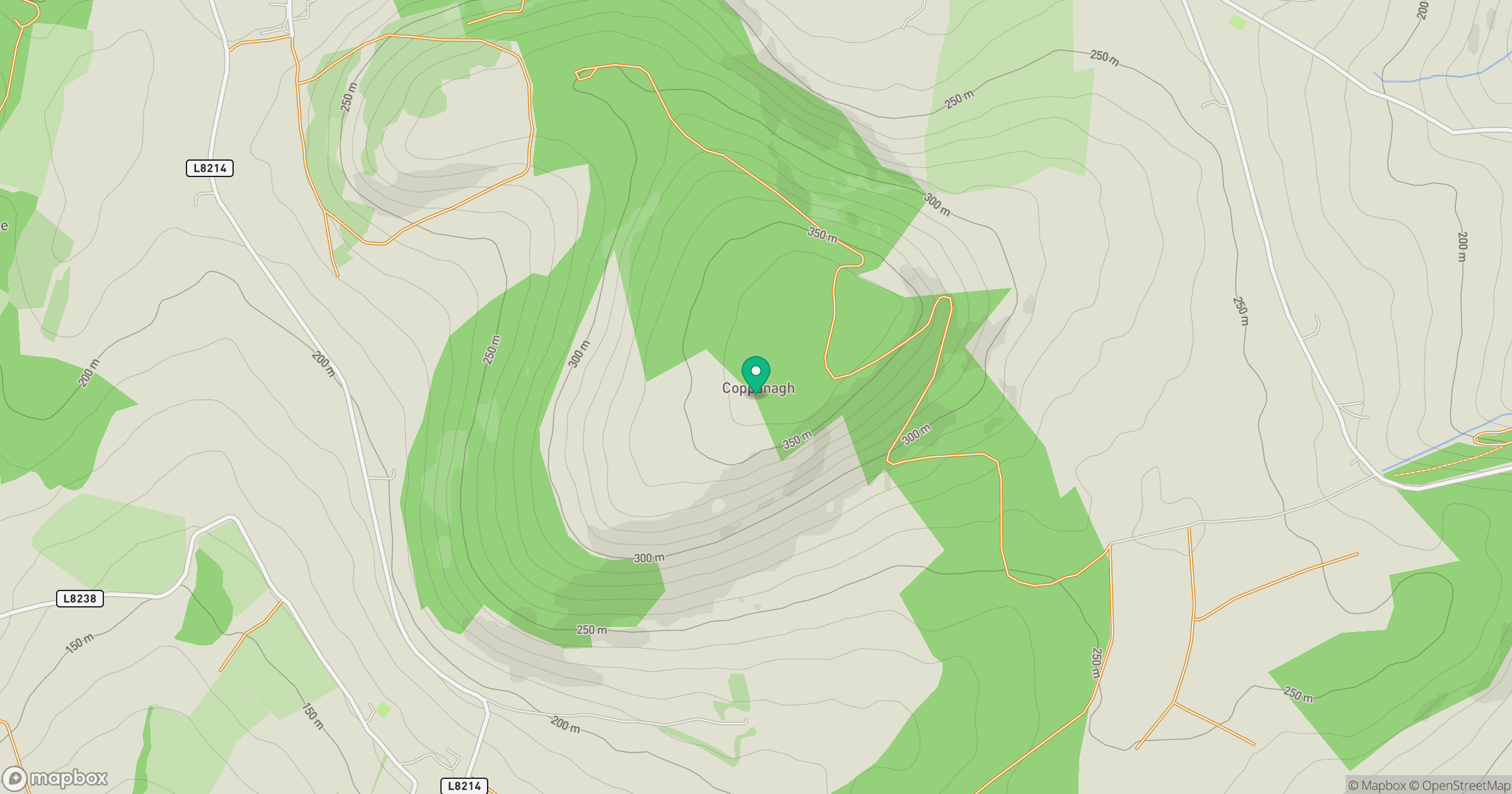
Grid reference: S651434
View on OpenStreetMapOpens a map in a new tab, centred on the hill.
Hills within 30 km
Straight-line distance, not a walking route or confirmation of access.
No comments yet. Be the first.